- Trailhead
- Trip Reports
- Photo Essays
- Map of Hikes
- Hike Calculator
- List of Links
- Why I Hike
- Mountain Towns
- Warning
- Misc. Photos
- Photo Credits
- F A Q
Please click on the mountain images at the top or bottom of the page to navigate this site. Sorry for this temporary inconvenience.
Geissler Mountain
Northeast PeakJune 31, 1996
White River National Forest
Hunter Fryingpan Wilderness
Starting Elevation:
11,5XX feet ?
Highest Elevation:
13,280 feet
Distance (round trip):
~ 4 miles?
click on each photo to view a larger image
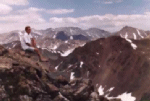
From the summit we could see the back side of Mount Elbert (the highest point in Colorado) and Mount Massive to the East, several beautiful valleys in the Hunter Fryingpan Wilderness to the north, the Elk Mountain range to the west and Huron Peak and the Collegiate Peaks to the south and southeast.
Our trip down was especially fun as we took advantage of a large, firm, homogeneous snowfield for our descent (Wheeeeeeeeeeeeee.......). We arrived back at the lake to meet up with Angeline and followed the trail back to the car.
Due to the season the Roaring Fork River (creek) was high and crossing it proved to be a (minimal) challenge. Without going in to details I will let you know that just after crossing the Roaring Fork, my day pack somehow slid down the bank of the river and went for a short but wild ride. Luckily, I was just downstream from this event and was able to jump knee-deep into the river to save my backpack similar to the way a shortstop fields a grounder. Just about everything stayed dry but I did lose my Aspen Highlands ballcap which at the time I lost it, was attached to a carabiner on the outside of my pack.
If you find my hat anywhere downstream (Roaring Fork River, Colorado River or the Pacific Ocean), please send me a note so that I may reclaim it. (Yeah, right!)
Along on this hike with me: Tommy and Angeline.


