- Trailhead
- Trip Reports
- Photo Essays
- Map of Hikes
- Hike Calculator
- List of Links
- Why I Hike
- Mountain Towns
- Warning
- Misc. Photos
- Photo Credits
- F A Q
Please click on the mountain images at the top or bottom of the page to navigate this site. Sorry for this temporary inconvenience.
Starting Elevation:
9,9XX feet ?
Highest Elevation:
13,641 feet
Distance (round trip):
~ 5 miles
click on each photo to view a larger image
Very close to the overpass, you will notice a creek coming down from the mountain. Again, near here we saw Private Property signs so we began our hike about a hundred yards west of the creek just on the other side of a small ridge. As I suspected, game trails in the area were plentiful so finding a clear way through the forest without a designated trail was no problem. While still down low near the highway our canopy was that of Aspen trees. As the end of the summer season was nearing we could hear the dry Aspen leaves still on the trees quake in the wind - hence the name quakies. A little further up and the quakies turned into coniferous trees (variety unknown). All the while, we were undertaking a somewhat steep and gradual climb as we made our way through the forest.
At one point while walking, I heard a bugling noise so we immediately stopped to listen for more. Unfortunately, the call we heard was the only one for that day and we never did get to see the elk that had made such a magnificient sound. Although I am not expert in the ways of elk, I believe that this was a little early in the for them to be starting their rutting season.
We persisted through the forest heading up (north) and ever so slightly east towards the creek. Safely above the private property we found ourselves along side the creek as well as a very worn trail (game trail?) that apparently had no begining. This soft dirt/compost trail climbed steeply up the mountain following the tumbling creek. All through the forest we noticed that there must have been a fire in the area quite some time ago as there were small charred stumps just about everywhere.
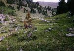
Several hundred feet below tree line (we could tell where it was by looking back across I-70 towards Torreys Peak) the valley leveled off a bit and opened up into a beautiful high alpine meadow. Here we were greeted by pica and marmot at the base of what appeared to be an avalance chute with the remains of old, huge trees still littering the ground. We knew they had been there for quite some time as the rocks that were loged in their (now above ground) root structure were free of the dirt that usually holds them in place (in recently uprooted trees). This meadow afforded us the opportunity to take a short break as ahead of us the climb appeared to be even steeper than what we had already encountered.
After our break, we persisted on up the steep western slope (east facing) above the creek which was by now a trickle. Several hundred feet higher we took another break at tree line. From here we had a clear line up the ridge all of the way to the summit (which we could now see ahead of us).
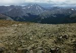
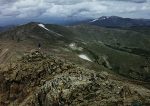
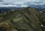
The ridge to the summit was steep in some places and not so steep in others. It was kind of stair-stepped (I'm stretching it here). Although the ridge didn't look that long, the summit kept running away from us. Some times it seemed as though we would never get there. The ridge curved slightly to the northeast (it had been going strictly north) and finally I could go no further to the north. The back-side of this mountain was a drop off several hundred feet to the valley below. What I thought was a hundred yard final pitch to the top turned out to be more like a quarter of a mile. The previously rocky slope turned into a carpet of low clinging green vegetation which I interpreted as a welcome to the summit.
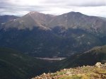
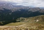
From the top, Mount Evans, the Sawtooth, and Mount Bierstadt were clearly visible to the Southeast. Directly south lay Grays and Torreys Peak, and Grizzly Peak. Further west, almost the entire Loveland Loop could be seen and immediately to the west was Mount Parnassus, Hager Mountain, and Pettingel Peak. Northeast I could see Colorado Mines Peak just above Berthoud Pass.
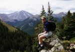
We had the summit to ourselves for about twenty minutes before we saw coming up the east ridge another party of three hikers. We visited with these hikers for a while and took turns taking each others photo. As today was another possible weather day and we could all see the clouds moving in on Torreys Peak, it didn't take much to convince us that the ceiling was dropping rapidly and that it was now time to go.
The route back down pretty much followed our route up the mountain with the exception of the fact that instead of heading back down the exposed ridge we chose to follow the gully which defined the character of the mountain. The trade off for this perceived safer route was that we now had no idea of the weather on the other (west) side of the ridge.
Once we had reached tree line again we felt safe from the worst of any impending storm. We contined to improvise our way back down through the forest, sometimes spotting places we knew we had passed earlier in the day. At one point I spied the backside of a Mule Deer about a hundred yards away as it ran from our position. Other than that our only other challenge was to find our way out without crossing the Private Property. Needless to say, we ended up about a hundred yards west of the western end of the westbound onramp to the highway so we did have to do a little backtracking to reach the car.
Final Notes: Even though this hike is very close to Denver, we didn't see anyone all day except for the three other hikers that appeared on the summit. If I had to give this hike a nickname I would have to call it The Run Away Summit as even though we could see the top, it seemed as though we were never going to get there.
Along on this hike with me: Bernie.

