- Trailhead
- Trip Reports
- Photo Essays
- Map of Hikes
- Hike Calculator
- List of Links
- Why I Hike
- Mountain Towns
- Warning
- Misc. Photos
- Photo Credits
- F A Q
Please click on the mountain images at the top or bottom of the page to navigate this site. Sorry for this temporary inconvenience.
Starting Elevation:
10,XXX feet ?
Highest Elevation:
13,52X feet ?
Distance (round trip):
11+ miles ?
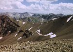
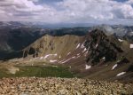
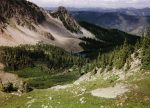
click on each photo to view a larger image
To reach Hayden Peak, head up the trail towards American Lake, cross over the ridge on your right, lose a little elevation to head up the valley, climb to the top of the ridge and finish with a straight shot 1000 feet to the summit.
Although I can tell you that this is not necessarily an incorrect description of how to get there I feel I must share with you my experience on this journey.
From the intersection of Colorado State Highway 92 and Maroon Creek Road in Aspen, Colorado, head southwest on Maroon Creek Road (the road that goes to the Maroon Bells and Aspen Highlands) for about 200 feet. Turn left on Castle Creek Road as it travels wouth towards the ghost town of Ashcroft. The trailhead to American Lake is just shy of Ashcroft - about 10 miles or so from Maroon Creek Road. The parking area is a little hard to see but it can be found on your right as the road turns right just as you approach a beautiful gentleman's ranch.
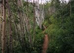
The trail starts out with a short walk across a meadow before it heads up five or so long and steep switch backs through a Quakie forest. After covering about a mile of these switch backs you will notice the vegetation change from Quakie forest to a coniferous forest. The trail begins to level off a little and you will see a beautiful meadow climbing up to a ridge on your right. After about another half mile of hiking and slowly gaining elevation the trail crests on a subtle ridge and begins to drop into the valley containing American Lake. Instead of following the instructions above and hiking almost all of the way to American Lake before climbing the ridge, I took a chance and decided that this was the ridge I was to cross anyway so why not just follow the game trail up the crest of the ridge? This was not a mistake with the exception of the fact that there were some places where I had to step over fallen trees and occasionally pick my way through a little brush. [Nothing at all like my experience on Mount Bierstadt.]
I continued up this ridge until I was faced with a steep but climbable slope. Did I need to climb this? I didn't know. Why not? I thought to myself. I may be able to get a view of my destination and I can always come back down the way I came up. After about ten minutes of steep climbing up grass / loose dirt / rock I reached the pinnacle of this rock. Just as I expected, this was a dead end but it did afford me with an incredible overview of American Lake and the next valley to the east containing my destination for the day.
I carefully climbed back down this mini-mountain until I was once again on top of the ridge leading up to it. This meant that my only way into the valley was to climb down a steep grass / loose dirt / rock slope to gain access to the valley to the east - one valley over from American Lake. Note: I did loose my footing once while descending this slope but was somehow able to stop myself after sliding somewhat less than ten feet down the hill. Be careful!
The floor of the valley was almost exclusively glacial till (possibly incorrect usage of the term). This meant that my options were to cross the valley floor to the other side where I would have to climb the valley by traversing a steep side slope or I could tough it out and do the rock hopping thing for a mile or so. I decided to walk up the rocks - I think due to my desire to come back as a mountain goat in the next life. :-) From the valley floor I spotted what I believed was Hayden Peak directly in front of me. It matched the description in my book - I could climb up to a ridge to reach it after a straight shot 1000 feet to the top - or so I thought. I pressed on up the valley until the stone gave way to a sidewalk of grass. There were a couple of ups and downs as I crossed the glacial moraines beneath the peak.
Near the head of the valley I took a break to eat a little and hydrate before climbing up to the ridge which would lead to my 1000 foot straight shot to the summit. Of course, by now I had to keep an eye on the weather as dark clouds passed through the Colorado cobalt-blue sky. With the summit directly above me and weather possibly moving in it was time to begin my hike up to the ridge.
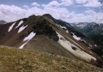
The climb to the ridge was much easier than I thought it would be even though it was steep and on small, loose, sedimentary rock and dirt. Once on top of this ridge, as the book said, it was pretty much a straight shot a 1000 feet or so to the top. Although I missed it on the way up, to my right, close to the edge of the ridge was somewhat of a trail that picked its way through the loose rock and occasional grassy spot.
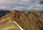
As I came upon the summit I noticed that just to my north, about a quarter of a mile away, was another peak - about 40 feet higher than the one I was on.
I Was On The Wrong Mountain!!!
The ridge leading to Hayden Peak from my current location looked pretty treacherous so due to the reasons listed below I convinced myself that I had reached my final destination for the day.
- I was alone and hadn't seen anyone for about three hours.
- The rock in the area was "rotten" (brittle, crumbling, etc.).
- It was 1000 feet or more down in any direction from the ridge between the peaks.
- Weather issues were still a concern.
- The headlines in the current Aspen newspaper stated "Woman falls from Pyramid Peak".
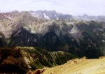
After dropping about the same distance on this side of the ridge as when I came up the other side, I found myself standing in a meadow full of wildflowers and grass. The sky was still blue with intermittent clouds and several distinct colors of stone towered above me to the Southeast. I took a break in the meadow - 'cause I could - and because I didn't want to leave. Finally, I packed up and continued on down the mountain. Somewhere along here I began to follow rock cairns which had appeared in the meadow. The cairns continued down the valley but once, near a gully, they seemed to disappear. I found the next cairn just over a small knoll on my left (north?). After another cairn or two I found myself looking almost directly down on American Lake.
Time for another break. I didn't want to leave. The air temperature was perfect, there was no wind, and I had no real pressing engagements drawing me back to the city by any certain time. Ahhhhhhh - paradise!
Realizing that I hadn't seen another person for almost six hours I figured it was time to get going again. The cairns led down a very steep grassy slope and then the trail turned right (northeast) towards the lake. After descending this steep slope I decided against recommending doing this hike opposite of the way I had come.
The trail drops down another short grassy slope following a creek which feeds the lake and shortly thereafter I was at American Lake. The trial winds around the east side of the lake until it once again heads back into the forest and down the valley. After about a mile or so I was once again at the point where I had originally left the trail. I continued on the trail through the forest until I reached the Quakies and switch backs - my feet were beginning to feel heavy. Just before reaching the trailhead I rinsed off my arms, legs, and face in the creek as it leaves its own valley and enters Castle Creek Valley. Another couple of hundred feet (distance) and I was back at my car.
Even though I never did reach my intended destination this was one of the most emotionally satisfying hikes I have ever been on. I am not sure if it was because I didn't see anyone for six hours or the ruggedness of the terrain but at the end of the day I felt that I had accomplished something. What? I don't know. Maybe I'll have to go back one day to find out.
Along on this hike with me: no one.

