- Trailhead
- Trip Reports
- Photo Essays
- Map of Hikes
- Hike Calculator
- List of Links
- Why I Hike
- Mountain Towns
- Warning
- Misc. Photos
- Photo Credits
- F A Q
Please click on the mountain images at the top or bottom of the page to navigate this site. Sorry for this temporary inconvenience.
Starting Elevation:
10,300 feet
Highest Elevation:
12,367 feet
Distance (round trip):
~ 6 miles
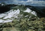
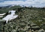
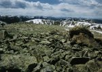
click on each photo to view a larger image
When the pavement ends about 30 miles east of Basalt, continue around the switch back to your left (follow the signs to Hagerman Pass). The road traces an old railroad grade so the climb is not so steep as to require four-wheel drive however there are several deep cuts (blind curve), wet areas, rocky areas, and fantastic drop-offs as you approach the trailhead. You may want to take a break in Sellers Meadow - you will know why when you get there (it's beautiful). About ten miles up this road and just short of the sign for Ivanhoe Lake look to your left and you will see a sign for Hagerman Pass. Continue up the short/steep hill towards Hagerman and within about 100 yards you will find yourself at the parking area/trailhead to Lyle Lake / Mormon Lakes. This is also where you will find the gate to Hagerman Pass.
The two mile hike to Mormon Lakes is relatively easy except for the fact that you begin your journey at 10,300 feet above sea level. You begin your hike by following the trail up a several switch backs and a short pitch to the south of the parking area. After a short distance, the trail levels off and you find yourself gradually climbing through several high alpine meadows with Lyle Creek meandering back and forth across the trail. Note: The ridge line above you to the east (your right) is the Continental Divide.
About three-quarters of a mile into the hike the trail will become slightly steeper (and in our case - marshy/wet). This is good news as it means that you have almost reached the half-way point of the hike with Lyle Lake lying just ahead. As Lyle Lake comes into view you will notice across the lake (to your left) a steep bowl which contained a large cornice while we were there. Getting around the lake requires some sure-footedness as the trail follows the shoreline across a boulder field (on the east side of the lake). The trail can be tough to find through the boulders but by following the cairns the hundred yards or so it is easily navigated.
Ahead you will see that the trail climbs up and over the saddle between the bowl (mentioned above) and the Continental Divide. Be sure not to miss the views in every direction from the top of the saddle! This is the longest/steepest portion of the hike and once you make it over the saddle, your elevation gain/loss will be limited. On our trip, we encountered our first snow near the top of the saddle but we were able to slog through to find the trail exposed at the top.
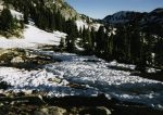
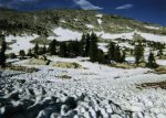
The trail continues north while traversing the ridge on your right (east). Mormon Lakes lay less than a mile ahead in the high valley you see further to the north. For us, the trail became quite wet as we encountered snow scattered throughout the traverse both in and out of the trees. In fact, we passed one couple that was trying to decide whether or not to continue. Of course, they didn't but we did. As a result we were justly rewarded!
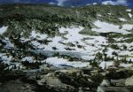
After about a half mile of traversing the hillside the trail moves a little towards the center of another saddle. We were still dealing with both snow and marshy ground - sometimes wandering off the trail for a drier surface - sometimes because we couldn't find the trail beneath the snow.
Just beyond the top of this second saddle, we found a dry spot large enough to set up camp (two tents) at around 11,500 feet. Apparently we were the first campers to reach this area this summer! Just over a small knoll and below our camp was the larger of the two Mormon Lakes (11,300 feet). We wouldn't discover the second, higher lake until the next day. The lake we could see however was still about 90% covered in ice so fly fishing probably would not be an option on this trip.
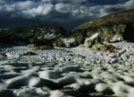
After setting up camp, Tommy and I decided to go on a "let's see how far we can go in our sandals" hike while Angeline took a nap and our hiking shoes dried. By carefully taking turns crossing snow and picking our way through the wet spots and boulders we were able to travel about a quarter of a mile West from camp where we took some early evening photos of the surrounding area. Just below us to the northwest was a steep drop-off of about 500 feet and we could hear a waterfall that was a result of the overflow from Mormon Lake(s).
After returning to camp it was time for dinner. After dark, with no moon in the sky the stars were outstanding with the Milky Way clearly visible in the night sky. After sharing our deep thoughts about time, space and the future it was now time to go to bed. The night was very cold (for the Fourth of July) and the next day we found that our water had frozen in our bottles as well on the open spots on the lake below.
The next morning, Tommy got up to see if he could catch any fish in the lake however upon finding the lake now completely frozen he returned - obviously empty-handed. We then decided to do a short climb up the unnamed mountain to our southeast. Even though we started our climb around noon, the snow near camp was still solid enough for us to walk on without post-holing through. This allowed us to gain access to the ridge which defined the western edge of a high north facing bowl (Mormon Bowl?) . This ridge was mostly dry so the climb to the top was relatively easy. We were later to discover the summit elevation of the peak was 12,367 feet.
From this unnamed summit our view was incredible! Just below us to the north lay the upper of the two Mormon Lakes - of course this one was still frozen solid. Further to the north lay Mount of the Holy Cross, to the northeast was the Gore Range, and to the northwest was Savage Peak. On the horizon to the west we could see the Elk Mountain Range in its entirety - beginning with Mount Sopris, Capitol Peak, Snowmass Peak, the Maroon Bells, and Pyramid Peak to the southwest. To the southeast of our position on top was Mount Massive including all five summits! Directly below us and to the east was Upper Homestake Reservoir with Homestake Reservoir to our northeast. We weren't sure if we were on the Continental Divide or not and as it turns out, we were on a ridge that was an offshoot of the Divide as it made its turn from east/west to north/south.
As we began to notice a possible weather situation brewing and with a hike out with a full pack ahead of us we decided it was time to go. Our route back to camp took us down the face of the summit we were on and along the ridge that divided Homestake Valley (?) from Mormon Valley (?). The ridge was very windy and just above Upper Mormon Lake we turned West towards camp which was about a half a mile from us but mostly snow. Luckily for us, the snow was still holding firm and we made it back to camp with virtually dry feet!
After another snack and packing up our gear, the trip back to the car was uneventful except for one last rest stop at the top of the first saddle. Our break allowed us to look back towards camp and survey the mountains around us. This was our last moment to reflect on the beauty around us before heading back to civilization...
Along on this hike with me: Tommy and Angeline.

