- Trailhead
- Trip Reports
- Photo Essays
- Map of Hikes
- Hike Calculator
- List of Links
- Why I Hike
- Mountain Towns
- Warning
- Misc. Photos
- Photo Credits
- F A Q
Please click on the mountain images at the top or bottom of the page to navigate this site. Sorry for this temporary inconvenience.
Starting Elevation:
~ 8,400 feet
Highest Elevation:
11,569 feet
Distance (round trip):
~ 4 miles
click on each photo to view a larger image
It was probably on one of my seasonal road trips without an agenda when I first drove by this peak. Rising up from the great plains of the midwest, Mount Maestas, along with the Spanish Peaks, are some of the first mountains you encounter when traveling West across southern Colorado. About 15 or so miles west of Walsenberg, Colorado, State Highway 160 climbs towards North La Veta Pass. I parked my car at a historical marker a mile or more before the crest of the pass.
My map shows that my intended destination is located on Bureau of Land Management property however the fence with the No Tresspassing signs indicated otherwise. For this reason I will not tell you the specifics of how I got to the actual base of the mountain (I knew that being on the mountain itself was not tresspassing)!
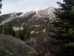
My plan on this day was to head directly up the face of the mountain straight to the top. In retrospect, I wish I had known of a trail. I choose my route by scanning the mountain looking for snow-free ridges. Since a major face of this mountain is south facing, finding a dry route to the top didn't appear to be a problem. What I would soon learn about this trip was that I shouldn't have been worrying so much about the snow. My problem was the fact that my chosen route to the top consisted of sharp, loose, rock and stone, that tended to slip and slide beneath each footstep.
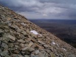
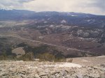
Now I'm not sure what the angle of repose is for this type of rock (see photo at right) but I'd be willing to bet that this is pretty much it. The going was very slow as every step had to be first visualized, planned, then executed. The rock under my feet was not stable (I would estimate) 95% of the time. The instabilty of this mountain became a challenge for me. I was becoming more comfortable (but never letting my guard down) on this slippery slope and provided the mountain would maintain this surface and if the weather holds out, I was going to reach the top.
Note: This hike is NOT recomended for just about everyone. I possibly tresspassed to reach the mountain and the surface was potentially very dangerous.
While slipping my way up the slope, my thoughts tuned to my journeys up Bald Mountain (because I headed straight up the face) and Paiute Peak (because of the fear factor, steepness, and danger involved). I remebered being on this sort of footing before and I tried to recall how to best deal with it. I remebered that I shouldn't trust any rock. I remebered that I should always step to the uphill side of any stone so that if it slipped I would be on top of it rather than it on top of me. Probably the most important thing I remebered was that if the rocks below you were sliding that was not good, but if the rocks above you were sliding, that could be fatal.
After a while, I was getting pretty good at this - stepping and sliding. Stop, plan, step and slide again. Occassionally I would do a little stone surfing for about a foot before I caught my balance and found stable footing. In some places I could make time, other places I had to stop and plan my next several steps. Sometimes I would use the small snowfields scattered throughout the face as the layer of snow over the rocks seemed to add stability to my footing. The only drawback to this was the fact that my feet ended up getting wet long before the summit.
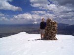
After climing one foot of vertical every four seconds for quite some time (OK - so I have an engineering background and with an empty mind, alone on a trip like this, the calculation came quite easy), I found myself just shy of the summit along a snow covered ridge. Not knowing if the snow were just a cornice clinging to the edge of the mountain, I approached it carefully until I could see solid ground on the other side. Once firmly upon this snow (and the ridge) I spied a huge carin several hundred feet ahead of me. I walked on the snow as it was a welcome respite to the unstable footing lower on the mountain.
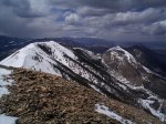
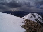
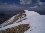
As I knew that there was weather in the neighborhood, I felt as though I should be in a hurry to scuttle out to reach all four of the peaks on this mountain. The carin was on the first peak, separated by about a hundred or more yards each were the second, third, and fourth peaks - each slightly higher than the previous one.
From the western-most and highest summit, out to the west I could see the San De Christo Mountains. I think that is Blanca Peak (14,345 feet) looming large to the west and Culebra Peak (14,069 feet) further south of that.
As you can see from the photos, the sky wasn't looking too promising for enjoying a long pleasurable stay on the summit. After taking these photos and grabbing a quick drink of water, I retraced my steps back along the ridge line. Notice that even though my path brought me across the snow I kept my distance from the edge. This was due to my respect for cornices along the ridge (even though at the time I felt the cornice was fairly stable).
Once back by the carin on the first peak I thought that I would take a break before heading down. This idea was short lived as several snowflakes encouraged me to continue my journey back down.
Heading down the mountain was no easier than coming up. Footing was still tenuous at best however sliding down the mountain was much more benificial to me than when I was on my way up. The snow that had threatened me earlier never did materialize thus allowing me to concetrate on getting safely back to my car.
About two-thirds of the way back down I was pretty proud of the fact that I hadn't fallen once! Of course I should've kept my mouth (thoughts) shut. Shortly after thinking these thoughts I had several slips where I ended up on my butt losing as much as ten feet in elevation before coming to a stop. The only thig hurt so far was my pride and as there was no one around to see this happen ...
Once I had reached the trees I unnecessarily let my guard down thinking that the footing was once again stable. This was a mistake. While traversing through a small stand, I somehow got my foot caught on a small rock, meanwhile my arms had become immobilized by dense brush. The result was a rolling tumble downhill to my left which banged up my left elbow and gifted me with miscelaneous cuts, scrapes, and bruises on my arms and legs.
Eventually I found myself back at the car having determined that this was a climb I would not soon repeat. I was thankful that I could climb such an impressive mountain this early in the season however due to the surface, next time I think I'll look for a trail.
Duplicating this hike is not recommended for anyone!!
Along on this hike with me: no one.


