Trailhead
Trip Reports
Photo Essays
Map of Hikes
Hike Calculator
List of Links
Why I Hike
Echo
Mountain Towns
Warning
Misc. Photos
Photo Credits
F A Q
Trip Reports
Photo Essays
Map of Hikes
Hike Calculator
List of Links
Why I Hike
Echo
Mountain Towns
Warning
Misc. Photos
Photo Credits
F A Q
Please click on the mountain images at the top or bottom of the page to navigate this site. Sorry for this temporary inconvenience.
Starting Elevation:
9,XXX feet ?
Highest Elevation:
12,260 feet
Distance (round trip):
~ 9 miles
click on each photo to view a larger image
The trailhead for Kneeknocker Pass is located beyond Piney Lake and the Piney Lake Ranch. To reach the ranch, exit I-70 at the main Vail exit (Exit 176) and follow the north service road west for about a mile until you reach Red Sandstone Road where you will turn right (north). Follow this road up through the subdivisions and at the top of the second or third switch back (sorry - I forgot) go straight where Red Sandstone Road turns to gravel. Continue on to Piney Lake Ranch by following the signs a total distance of around eleven miles. About 8 miles into this drive you will view your destination high up in the Gores to the north. Just outside of the gate to the ranch you will find a trail access parking area.
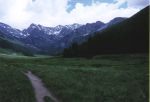
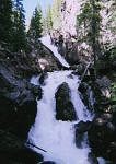
Walk through the gate to the ranch and when you see Piney Lake keep to your left to find the trail. [When we were there the trail went just to the left of the Tipis which may or may not be there when you get there.] With Piney Lake on your right the trail hugs the south facing side of the valley. Continue up this trail as it travels through a rather flat high alpine valley with Piney River on your right (south). After about two-and-a-half miles the trail climbs slightly so as to rise to the top of a waterfall. You will hear the waterfall before you see it and you really need to go off-trail a little for the best views. As this area sees heavy foot traffic you shouldn't have any problems relocating the trail through the woods.
Several hundred yards above the waterfall (flat hiking) you will have to look carefully to spot a rock cairn just off the trail on your left. Don't miss it as this is the trailhead you are looking for!
As this trail begins you will notice that not only is it not well marked but that it also appears to be in need of some clearing and maintenance. Almost immediately the trail climbs steeper than anything encountered on the hike so far. It follow what seem to be random switch backs to gain elevation. Several hundred yards into the hike you may want to take in the views while resting on the huge smooth rock outcroppings. Catch your breath now - the climb has really just begun.
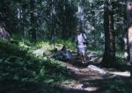
As the trail continues to wind its way up through a Quakie forest (Aspen trees) you will notice a small stream cascading down the mountain on your right. You will follow this stream to above treeline where it begins as glacial/snow runoff. On the way up you will notice that in most places the footing is good soft dirt and organic material but you will also notice the trail climbs sharply. In some places the trail is almost overgrown and in others you may need to navigate across downed trees or muddy runoff crossings.
After about a mile of this steep climbing you will find yourself in a beautiful valley above treeline at around 11,000 feet. Above and in front of you is Mount Powell and just to your right (east) is dramatic Peak C. As we arrived in this basin we were greeted by a small herd of Mountain Goats. This time (see the trip report for Peak 1) they were more than willing to give us our distance. We entered the basin by following what was to become the stream below as it passed through what appeared to be a break in an ancient glacial terminal moraine. Once we had passed through into the valley we were all but surrounded by majestic, rugged, they-really-made-'em-out-of-rock, peaks. For the time being we were now crossing both a beautiful grass meadow and a marshy ground.
As we did not know our exact destination for the day at the time (we were actually hoping to bag Mount Powell) this gave us the opportunity to really look up at the mountains as we scouted our route to the top. As we looked up at the mountain, high up on the West flank of Mount Powell we spied three climbers slowly crossing a snow field. Cool! Lower down between Mount Powell and Peak C we could see a trial that appeared to head to the pass between the mountains.
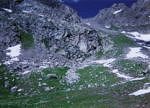
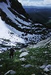
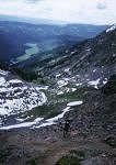
We crossed the basin to reach this trial and shortly after beginning our climb two young men passed us on their way back down. By now, the trail was steep - about as steep as you can have while hiking on soft/loose dirt (that's steep!). In some places the trail made attempts at short switch backs but these too were very steep. In several places the trail crossed small snow fields and this gave us the opportunity to get lost. Actually, we found what we thought might be a trail that would lead to the summit of Mount Powell but this trail dissipated and we found ourselves faced with a traverse. We were still low enough on the face that we were able to find a way through the rocks about 200 yards east back towards the trail which by now was heading directly up the face between the peaks. After once again gaining access to this trail we continued to slog our way up heading for the pass between the peaks. 1,260 feet above the basin we found ourselves at what we would later discover was called "Kneeknocker Pass" (elevation 12,260 feet).
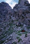
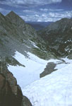
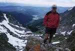
Directly to our west (above us) was a 50 foot (?) rock spire with a steep rock face as its backdrop. Unfortunately for us, this is the general direction we were hoping to find a non-technical route to the top of Mount Powell. Towering above us to the East was Peak C. On the back side (north) of the pass was the remnants of a huge cornice - I would estimate it extended 40 feet or more from where we stood. Maybe we weren't motivated or maybe we were afraid of potential weather but neither Mount Powell or Peak C appeared to be a realistic destination today.
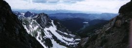
We settled in and removed our packs. The clouds and any potential storms appeared to be holding off for now. In the area we saw lots of wool which must have come from the Mountain Goats below. [We were in their neighborhood now!]. To the north we could see the pyrmidic shape of Dora Mountain as well as the mountains along the northern Continental Divide off in the distance. To the south we could see the many other rocky spires and sub peaks that make up the rugged appearance of the Gore Range. To the southwest the valley unfolded below us. We could easily see all of the way back to Piney Lake and beyond. I even thought I could make out Mount Sopris and Capital Peak located miles away on the horizon. To the east - rock. To the west - rock.
After about a half hour at the top of the pass and one wind-producing temperature-chilling cloud passing overhead it was getting late in the day and time to head back down. We were able to quickly descend the pitch to the basin below as we both were hiking with poles which gave us lots of stability on the steep / loose surface. I didn't want to leave this basin as it had a magical feeling to it. We stopped for one more break in the basin and enjoyed the surroundings. Eventually it was again time to leave and just above treeline I realized that my favorite time of the day is high up in the mountains about two hours before sunset.
Along on this hike with me: Bernie.

