Trailhead
Trip Reports
Photo Essays
Map of Hikes
Hike Calculator
List of Links
Why I Hike
Echo
Mountain Towns
Warning
Misc. Photos
Photo Credits
F A Q
Trip Reports
Photo Essays
Map of Hikes
Hike Calculator
List of Links
Why I Hike
Echo
Mountain Towns
Warning
Misc. Photos
Photo Credits
F A Q
Please click on the mountain images at the top or bottom of the page to navigate this site. Sorry for this temporary inconvenience.
Starting Elevation:
~ 10,100 feet
Highest Elevation:
~ 10,900 feet
Distance (round trip):
~ 5 miles
click on each photo to view a larger image
Previously I had taken a day hike (not reported here) up the west side of Arapaho Pass (the hike up the east side of Arapaho Pass is reported here). I recalled that the hike was relatively easy and hoped that the drive up would afford us the opportunity to find a place we could car camp the evening before the hike.
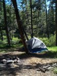
To reach the trailhead of Columbine Lake Trail, travel about 7 miles north of Winter Park on US Hwy 40. Just before the town of Tabernash, turn right onto 84 Road (later known as FR 129) and follow the signs towards Meadow Lake. Arriving near sunset, we stopped at a campsite along the road which (we were to find out later) was about a half mile below Meadow Lake.
As we had both slept in and finally had a good night's sleep, that morning we opted to hike rather than drive to the trailhead. This turned out to be not such a good idea as I didn't recall that the distance from the dam to the trailhead was about 2 miles. Hiking along the road, we were to find out, ate into our precious time in the mountains.
Eventually, we found the trailhead and we were surprised to find it marked Junco Lake. Fortunately, in the parking lot for the trailhead there was a Forest Service / Wilderness Camping registration booth and just outside of that was a bulletin board with several detailed maps of the area. As it turns out, Junco Lake is only the name of the trailhead as right next to the parking lot lay Junco Lake. After determining that our correct route would be to follow the Columbine Lakes Trail, we headed in that direction (east).
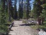
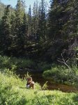
The trail was not steep but gradual as it followed the valley floor. Apparently we were traveling the old roadbed that made up the original crossing over Arapaho Pass. The ground was extremely rocky (imagine that - in the Rocky Mountains no less), and in many places water was flowing freely down the parallel ruts which made up the trail.
After about two miles along the trail we were faced with a choice. Columbine Lakes Trail forked and the route to the lake headed right (southeast) while the route to Arapaho Pass headed to the left (northeast).
Not wanting to pass up the challenge of getting to the top, Shelly convinced me that even though her feet were blistered, she wanted to head up towards the pass. Of course, the trail then changed from a nice flat walk into a steep walk around downed trees.
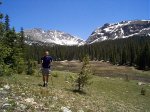
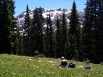
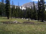
After gaining probably a couple hundred feet of vertical elevation along sloppy trail, we found ourselves hiking along the edge of a beautiful, almost level, meadow. Portions of the meadow were still rather marshy however much of the ground was dry. As Shelly's feet were still bothering her - especially on this steeper portion of the climb - we decided to take a break and enjoy the view from this meadow. While avoiding the bountiful gifts that the elk had left throughout the meadow, we found a spot which was not too wet where we could stop to hang out for a while.
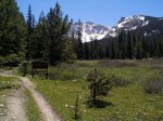
Once we got our packs off, I wanted to go a little further up the hill where I thouht I could use my binoculars to see if the trail ahead were passable. By now I recognized the area (from my prior trip up this trail) and knew where to look. East of our current position, the trail continued across the meadow, through some more trees, and finally emerging to a point where it began a steep traverse above treeline to a point where Apapaho Pass could be found. Unfortunately for us, the traverse appeared to be almost completely covered in snow while the higher portion of the trail seemed to be clear. As Shelly was not having a particularly good shoe day, we opted to spend the rest of the time we had available just enjoying the view and the peace and quiet of the meadow.
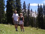
After eating some of the food we had brought (Italian Bread, Gouda Cheese, hummus, and of course, a Diet Coke ™ for Steve), enjoying the fact that no one else had bothered to take this branch of the trail, borrowing a few rays of sunlight, and wallowing in thousands of small wildflowers, we decided it was time to go. One last pose for the camera (self timer) and we were on our way back down.
The trip down was just like the trip back up - only in reverse. Not much had changed since we had passed this way about an hour or so prior - so there really isn't that much more to tell. We made it back to our campsite quicker than we had expected ( due to a ride in the back of a pickup truck - "No, YOU get us a ride ..." ) so we took advantage of the extra time and spent it in the mountains rather than wasting it back in the city.
Even though we didn't make it to either Arapaho Pass or Columbine Lakes, this area was so inviting, so uncrowded, so accessable, and so beautiful, that I hope to return again soon for another night in this valley.
Along on this hike with me: Shelly.

