Trailhead
Trip Reports
Photo Essays
Map of Hikes
Hike Calculator
List of Links
Why I Hike
Echo
Mountain Towns
Warning
Misc. Photos
Photo Credits
F A Q
Trip Reports
Photo Essays
Map of Hikes
Hike Calculator
List of Links
Why I Hike
Echo
Mountain Towns
Warning
Misc. Photos
Photo Credits
F A Q
Please click on the mountain images at the top or bottom of the page to navigate this site. Sorry for this temporary inconvenience.
Starting Elevation:
11,669 feet
Highest Elevation:
14,060 feet
Distance (round trip):
~ 6 miles
click on each photo to view a larger image
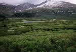
The hike begins from the crest of Guanella Pass (elevation: 11,669 feet) eleven miles south of Georgetown. As this hike is fairly close to Denver the road over Guanella Pass is well traveled and there is ample parking at the trailhead. From the parking area as you look to the east you will see Mount Bierstadt in its entirety - about a mile away and across a beautiful high country meadow - or so I thought.
As I had a late start (I didn't begin my hike until around 10:45 a.m. - usually a "no-no" due to impending afternoon weather issues), I was in a hurry cross the meadow so as to reach the base of the mountain and begin the actual climb. Quickly I discovered that the journey to the mountain would not be so easy. The meadow lay 100-150 feet below the parking area and after several hundred yards of hiking on dry trail through the chest high willows (which were everywhere) the trail soon turned to swamp. Of course this slowed progress considerably as I had to skirt the edges of the swamp/trail - sometimes jumping from side to side to try to keep my feet from getting too wet and muddy. After several hundred yards of slow going the trail once again became dry and my attitude changed accordingly.
Several hundred happy yards later the trail crosses Gomer Creek (?) which at this time of year was running quite high. While some other hikers in the area opted to remove their shoes to cross the creek barefoot, I chose to walk up-creek to look for a dry crossing. About a hundred yard upstream (just below the second beaver dam above the trail crossing) I found a way to cross the stream by making four small, three-foot crossings. Back downstream I once again found the trail (dry again) and followed it thorough more dense willows southeast towards my goal for the day.
The trail climbed slowly up to a point at which was approximately three quarters of a mile from and about the same elevation as the parking area. From here the trail began a slightly steeper climb (although still surrounded by dense willows). After a few minutes of hiking along this trail I came to a "Y" where a choice had to be made. One trail headed further to the north (left) while one appeared to head straight to Bierstadt (right). Guess which one I took and which one I should've taken! [do as I say - not as I do] I chose the trail on the right which soon became a downhill swamp. After gaining about a hundred feet in elevation my mistake pretty much disappeared into dense willows. With a clearing visible several hundred feet in front of me I decided to bushwhack my way through the willows. Big mistake! After many aggravating minutes and multiple deep scratches in my legs I finally found myself on what I would later discover was the trail that originally went to the left! Hint - go left at the "Y".
Safely back on a dry trail my attitude once again was positive - of course this would not last long. The trail now climbed steeper and basically went straight up the face of Bierstadt on the west-northwest side. As the weather was warm and there were many small snowfields higher up, there was a lot of runoff heading down the mountain - mostly on the trail. Actually the entire slope was pretty marshy and I even slipped once and ended up with a temporarily wet leg. After crossing one snow-gully low on the mountain I encountered two girls (women) with the same goal - Mount Bierstadt. We spoke briefly about the incoming weather, how long it had taken them to reach this point, the swamp, and the willows below (they encountered similar problems even though they had taken a slightly different route). After a minute or two of hiking with them they were soon left behind as they took frequent short breaks.
Alone again I continued up the face of the mountain. Several groups of people who had started much earlier in the day passed me on their way down and by now I could see many other people scrambling ahead of me while trying to pick their way through the dry spots. I felt that this portion of the climb was fairly steep however it could have been the elevation - now in the 13,000 foot range. Although the scenery surrounding me was quite spectacular the climb itself had become somewhat uneventful other than the constant attention required to the pursuit of dry/stable footing.
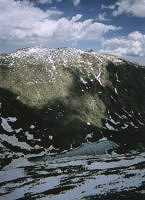
The marshy climbing surface (with little rock islands) extended to within several hundred feet of the summit with a slight change in direction to the northeast (the route was basically southeast) where it finally it turns into a scree/boulder field. The final pitch provided the best footing of the day as it was dry except for small patches of snow which could easily be avoided. This several hundred feet of scrambling through scree ends along a semi-narrow ridge with the remains of a cornice and the corresponding drop-off below to the right - and more scree to the left. The walk on the firm snow produced a discovery that the ground had become fairly level. The actual summit of Mount Bierstadt is small to moderate in size but of course there was room enough for the many people who were up there. Only about a half a dozen people could be on the actual summit at any given time.
Seeking a little bit of solitude I spied a pile of rocks about 30 feet below and 100 feet north of the summit (towards Sawtooth). To get there I had to cross one precarious mini-ridge covered in snow where to my right (east) was a drop off of what appeared to be about a thousand feet and on my left was the same - albeit not quite as steep.
After enjoying about 15 minutes of relative solitude I decided to head back to the main summit as some of the crowd had gone back down. There was still a group of five hikers on the summit and after I took their photo they offered - and I accepted a home-made banana nut muffin. Ummm - good (or maybe I was just happy to eat something other than a Clif Bar while on top of a summit). Kudos to the unnamed person with the sharing spirit! Soon after the muffin, the group of five left the summit and I had it all to myself! The clouds just overhead opened up and I could see the brilliant Colorado blue sky as the sun warmed my body which had been chilled by the cloud-induced winds.
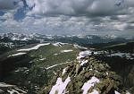
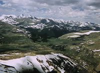
From the summit, visible is Mount Evans (including the new telescope operated by the University of Denver) directly to the east, Mount Parnassus to the Northnorthwest, and Grays and Torreys Peaks to the west-northwest. To the south is South Park (how appropriate) while the Collegiate Peaks are to the southwest. On the horizon to the west I could just barely see the snow cross of Mount of the Holy Cross. Between the summit of Bierstadt and Evans, deep in the valley below lay Abyss Lake which was still mostly covered by ice (except around the edges). Below and to the west-northwest is Guanella Pass and the parking area.
After adding and removing clothing (due to the ever-varying weather) and enjoying the summit for quite sometime, I was just about ready to head back down when the two girls (mentioned earlier) finally arrived! I gave Sue and Sharon a "tour" of the scenery around us and took their photograph for them. Their stay on top wasn't as long as mine and we headed back down the mountain together.
As it turns out their experience on the way up mirrored my own so we were all anxious to try to find a drier/safer way back down. Unfortunately we had no such luck and Sue actually slipped twice but was fortunate to not obtain any injuries other than a bruised butt and a hurt ego (or so she said). By sharing our wet boot stories, our willow stories and talking about our own hiking experiences, the trip back down didn't seem quite as uncomfortable as it could have been.
This time we stayed on the trail thus eliminating our shared but separate bushwhacking experiences (but not altogether avoiding more water). I led them to my dry crossing of Gomer Creek and as we traversed the swamp meadow we saw our first lightning strikes of the day. As we were now almost back to the parking area I will conclude this report with the following words of advice:
Timing is everything!
Along on this hike with me: No one (Sue and Sharon on the way back down).

